Thank you for subscribing

You’ll be sent the latest news, exclusive offers and competitions to your inbox.

Best bike trails in Melbourne for adults and kids

A bike rider cycling past the beach and restaurants in St Kilda
RACV

November 26, 2025

Discover Melbourne’s best bike trails, from coastal paths to creek-side routes. From north to south, east to west, these easy, accessible rides highlight some of the city's best green spaces.

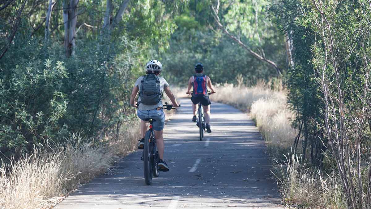
Beautiful, charming, sprawling Melbourne stretches about 100km from west to east and 85km from north to south, living up to its reputation as one of the world’s most liveable cities with incredibly diverse landscapes.

These range from stunning coastlines and historic parks and gardens to native bushland and wetland areas that are perhaps best discovered on two wheels.

Bike paths suitable for adults and children are found across Greater Melbourne, so let’s take a ride along five of the best trails that showcase the city’s green wedges, abundant marine and birdlife, historic landmarks and more.

RACV’s Arevo Bike Map makes for an easier ride with turn-by-turn cycling directions, and helps you plan the most suitable journeys, taking full advantage of Melbourne’s bike lanes. Plus, RACV Bike Assist can help prepare you for unforseen events while cycling, such as flat tyres or unforseen bad weather. 

Older person riding bike on St Kilda foreshore shared pathway with pedestrians sitting on boardwalk behind

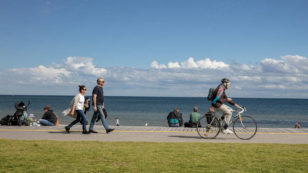
There’s always lots of action along St Kilda beach. Image: Tourism Australia

New bike trails in Melbourne for 2025 and 2026

Federation and Kororoit Creek bike trails

As part of the West Gate Tunnel project, Melbourne is getting 14km of new and upgraded bike paths throughout the inner west.

The new bike trails connect the existing Federation and Kororoit Creek bike trails, improving connections to other popular bike trails, new off-road paths and bridges, new paths over and under the West Gate Freeway, and the much-discussed elevated veloway over Footscray Road. 

This veloway, sometimes called the cycling superhighway, provides bike riders a dedicated express route to and from the CBD from Melbourne's west. Importantly, this bike path allows cyclists to avoid six busy intersections along Footscray Road. 

Entrance to the veloway is from either near Shepherd Bridge in Footscray or from near Moonee Ponds Creek.

These new bike trails and upgrades are expected to be completed by the end of 2025.

Dandenong Creek and Eastlink bike trails

A 3.5km trail is being built as part of the new 35ha ngarrak nakorang wilam park in Melbourne’s outer east. The trail will run east-west from Forest Hill, through Vermont, and connect to both the Dandenong Creek Trail and Eastlink Trail. It is expected to be completed by mid-2026.

The shared-use trail will include seating, drinking fountains, lighting, and signage to support cyclists, runners, and walkers.

The park itself will stretch from Springvale Road to Morack Public Golf Course and Boronia Road, forming part of Melbourne’s strategic cycling corridor network and linking to other cycling routes.

The park's name was chosen by the Wurundjeri Woi Wurrung Cultural Heritage Aboriginal Corporation to celebrate Wurundjeri Traditional Owner connections to Country and the role of parks in bringing people together. 

Melbourne's CDB

Melbourne is set to have more than 50km of protected bicycle lanes by 2030, as part of the City of Melbourne's Transport Strategy. You can find out about upcoming projects here.

Map showing best bike trails in Melbourne around Port Phillip Bay and near Yarra River

Five of the best bike trails in Melbourne

Bay Trail: St Kilda to Ricketts Point, Beaumaris

Port Phillip Bay beckons as a prime location for bike enthusiasts and the Bay Trail that stretches along the coastline offers stunning views of the bay, beaches, bobbing boats and Melbourne’s CBD that stands proudly behind. 

This scenic, leisurely route we’ve nominated here starts from bustling St Kilda and its famous pier and penguin colony and navigates around the bay to leafy Elwood, Brighton, Sandringham and Black Rock before ending at Ricketts Point, Beaumaris. The ride is relatively flat from start to finish and takes in pretty coves and cliffs, coastal scrub, dunes, beachside parks and marine sanctuaries.

  • Start: St Kilda Pier
  • Distance: about 17km one way
  • Difficulty: Easy, but it’s a popular trail so keep an eye out for walkers and other path users.
  • Highlights: Point Ormond lookout at Elwood for a breathtaking view of the city, Brighton Beach bathing boxes, and HMVS Cerberus shipwreck at Black Rock.
  • Pitstop: Park the bike at Half Moon Bay in Black Rock, kick off your shoes and enjoy the calm, protected cove. Stop in at the Cerberus Beach House Kiosk for top-class fish and chips.
  • Best for: Sea breezes to blow away the cobwebs.
Gardiners Creek Trail with gravel bike path, gum trees, shrubs and reedy billabong

Gardiners Creek Trail takes you through some beautiful and peaceful areas. Image: Getty

Gardiners Creek Trail: Toorak to Blackburn

Melbourne’s leafy eastern suburbs live up to their name in this lush green corridor that follows the path of Gardiners Creek through parks, reserves, sporting fields and wetland areas.

The trail starts from the striking Yarra River in Toorak, heading east away from the Main Yarra Trail through Kooyong, East Malvern, Burwood and Box Hill South before reaching some remarkable bushland areas in Blackburn. It’s a family-friendly ride with well-established paths and abundant birdlife along the way.

  • Start: Heyington Station, Toorak
  • Distance: about 17km one way
  • Difficulty: Easy, with a gentle incline.
  • Highlights: Blackburn Creeklands and Blackburn Lake will have you marvelling at such natural beauty so close to the city. Look out for ducklings trailing their mothers on the creek.
  • Pitstop: The wetlands deserve more than a passing glance as you cycle by. Park the bike and wander or just find a bench and sit.
  • Best for: Nature lovers – think stunning autumn colour, shady avenues and plentiful birds and wildlife.
Man and woman looking at large circular outdoor sculpture in parkland at Heide museum

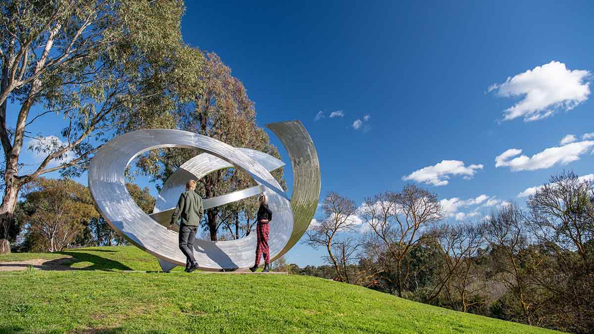
The sculpture park at Heide Museum of Modern Art is spectacular. Image: Visit Victoria  

Yarra Trail: Fairfield to Heide Museum of Modern Art, Bulleen

The scenic Yarra Trail (or Main Yarra Trail) is a majestic biking artery that runs from Melbourne’s CBD through to the northeastern suburbs, following the vast Yarra River and offering new perspectives at each bend.

This short, challenging and memorable green corridor we’ve outlined here starts at the historic Fairfield Park Boathouse and Fairfield Pipe Bridge, passing alongside ancient gums, billabongs, wetlands and, for contrast, golf courses, genteel parks and manicured lawns. The city views are outstanding and the destination, the Heide Museum of Modern Art, no less impressive.

  • Start: Fairfield Park Drive
  • Distance: about 10km one way
  • Difficulty: Some steep climbs, but worth it for the city views.
  • Highlights: Amazing vistas at Wurundjeri Spur Lookout; birdlife and tranquillity at Alphington wetlands, and world-class art and peaceful heritage-listed gardens at Heide Museum of Modern Art.
  • Pitstop: Bring a picnic to enjoy in the 6ha Heide grounds or visit the stylish Heide Kitchen. Leave enough time to take in an exhibition or wander the sculpture trail.
  • Best for: A lazy Sunday afternoon.
Historic Armstrong Cannon facing Port Phillip Bay at Williamstown with Melbourne city skyline behind

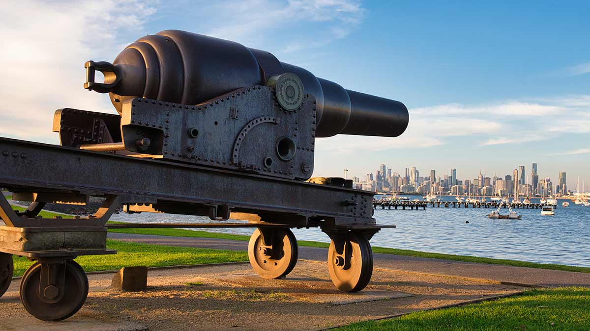
Williamstown offers points of historical interest and beautiful views across Port Phillip Bay. Image: Getty

Hobsons Bay Coastal Trail: Williamstown to Altona

We’ve already taken a ride along an eastern stretch of the Bay Trail from St Kilda to Beaumaris, so now it’s time to soak up the wonders of the Bay Trail West, which is better known at this point as the Hobsons Bay Coastal Trail.

The captivating trail starts near the imposing West Gate Bridge and now extends 23km to Skeleton Creek at Point Cook, although our focus on this shorter 10km route is from Williamstown to Altona Pier. You’ll see historic buildings and markers, dedicated coastal trail artworks, impressive city views, nature reserves, marine sanctuaries and internationally recognised wetlands. Also lots of opportunity for boat, bird and bay watching along the way.

  • Start: Williamstown Station
  • Distance: about 10km one way
  • Difficulty: Easy riding, with a well-signposted path. Note that flooding can occur around Cherry Lake and the grasslands between Millers and Altona roads after heavy rain.
  • Highlights: Historic Armstrong Cannons (c1864) and Port Gellibrand Lookout at Williamstown; marine and birdlife at Jawbone Marine Sanctuary; wetlands, grasslands, saltmarsh, mangroves and more at Jawbone Flora and Fauna Reserve; plus native birds and butterflies at Cherry Lake.
  • Pitstop: Drop in to The Kiosk d’Asporto on pretty Williamstown Beach for panino, gelato, espresso and people watching.
  • Best for: Warm weather so you can finish your ride with a swim at the beach (there are changing facilities at Williamstown Beach).
Two cyclists riding in single file on bushy Merry Creek Trail

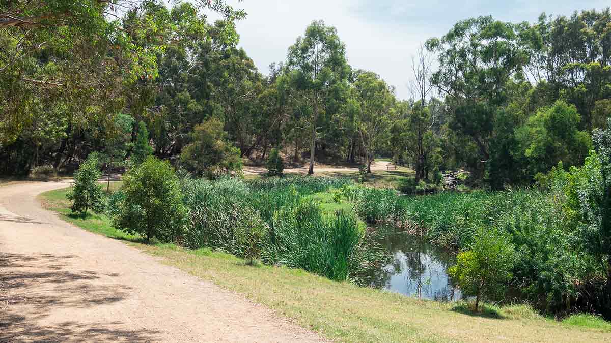
You can feel like you’re a long way from Melbourne on the Merri Creek Trail. Image: Getty 

Merri Creek Trail/Yarra Trail: Coburg to Abbotsford

This combination itinerary starts north of the city at Coburg near the infamous Pentridge Prison (now a tourist attraction) and the historic Merri Creek Bridge at Murray Road (c1870). Head south along the burbling Merri Creek past market gardens, pretty reserves, parks, wetlands and historical landmarks.

Upon reaching Clifton Hill, you’ll join the Yarra River at Dights Falls, linking into the Yarra Trail (or the Main Yarra Trail) and going downriver through Abbotsford to the Collingwood Children’s Farm. Despite the nearby industry, high-density housing and traffic, this inner-city trail is a little oasis of nature, disturbed only by the sounds of birds, footy games and children playing.

  • Start: Join Merri Creek Trail at any of the entry points near Coburg
  • Distance: about 12km one way from Bell Street
  • Difficulty: Easy riding with one or two short, steep hills and some inconvenient steps.
  • Highlights: Ceres Community Environment Park, Islamic Museum of Australia, Dights Falls and nearby parks and swimming holes, plus Collingwood Children’s Farm.
  • Pitstop: It’s hard to go past the Farm Cafe at Collingwood Children’s Farm, the perfect place to refuel with an excellent all-day breakfast and all-day lunch menu.
  • Best for: An escape from the city, in the city.

Best bikes rides in regional Victoria | RACV video


Don't let a flat tyre stop your cycling adventure

Discover RACV Bike Assist