
Learn what you can and can’t do after a 'total fire ban' has been declared, and how it’s different from a fire danger period.
Bushfires


What emergency numbers and apps should I know for bushfire season?
How to prepare your home and family for bushfire season
Preparing for Victoria’s bushfire season is essential to help protect lives and property. In this guide, RACV shares advice and safety tips to help you get your home and emergency plan ready for the increased risk of bushfire this summer.
Everyone in Victoria who lives near dense forest, bush, grassland or the coast needs to prepare their property for bushfire, the Country Fire Authority (CFA) advises. Bushfire season generally spans from late spring through summer and into early autumn, but it's prudent to be prepared year-round.
RACV's General Manager of Insurance and Roadside, Bill Bloodworth, says it’s crucial Victorians have a clear bushfire plan and stay informed to ensure they are best prepared for the peak fire period.
“The state could be facing an increased bushfire risk this summer, and RACV is urging Victorians living in high-risk areas to take action now to prepare their household and property,” Bloodworth says. “One in five Victorians live in high-risk areas – we’re urging you to prepare before the weather gets too hot.
“Make sure you have a plan and know how to stay informed, prepare your property and review your home insurance.”
Even after a period of rain, Victoria's weather can turn hot and dry and the new abundant vegetation can dry out and become flammable.
This guide sets out practical steps for assessing and protecting your property, along with ways to avoid being underinsured.
In this article
- How to assess your property's bushfire risk
- Practical ways to help protect your home and property
- How to develop a bushfire survival plan
- How to check your home insurance policy is up to date
- How to prepare your motor vehicle for bushfire season
- Emergency services resources to help you stay informed
How to prepare for bushfire season
You don’t have to live in the country to be at risk of fire. If you live near or plan to travel to areas that have significant bush, forest, long grass, or coastal scrub, then plan ahead for the fire season.
How to assess your property's bushfire risk
Understand your location and exposure
Properties on the urban fringe, near grasslands, or adjoining bushland face increased risk from ember attack, radiant heat, and direct flame. Consider how local topography, prevailing winds, and surrounding vegetation could influence fire behaviour and the likelihood of fire reaching your home. Houses on slopes, ridgelines, or elevated positions may experience faster fire spread and more intense embers.
Monitor fire danger ratings
Throughout summer, regularly check official fire danger ratings and local advice. The Australian Fire Danger Rating System provides clear categories indicating the likelihood of fires starting and becoming difficult to control. On Extreme or Catastrophic fire danger days, avoid outdoor work, secure your property, and be ready to enact your bushfire plan early.
Identify and address hazards
Conduct a property walk-through to spot potential hazards such as overhanging branches, leaf litter, dry grass, timber piles, flammable outdoor furniture, stacked building materials, and gaps where embers could enter. Pay attention to areas under decks, around sheds, carports, and near windows. Map these hazards, prioritise actions to address the most critical risks first, and schedule the rest in manageable steps.
More: Things you need in your bushfire survival kit
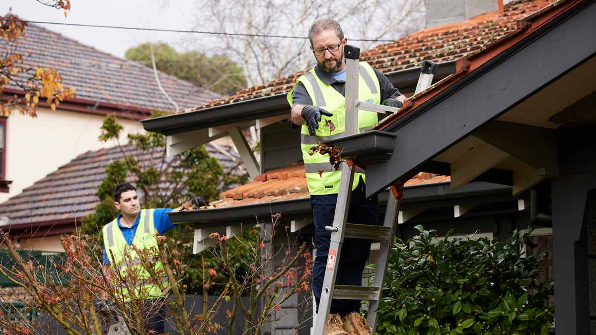
Keep up a regular home and garden maintenance routine to help make your home safe
Practical ways to help protect your home and property
Clean and seal
- Clear gutters and downpipes of leaves and debris to prevent fire spread into roof cavities.
- Install metal gutter guards to reduce future build-up.
- Inspect and seal gaps in roof spaces, eaves, vents, and service penetrations to block ember entry.
Reduce fuel around your home
- Trim vegetation and remove combustible materials near external walls, decks, and verandahs.
- Keep grass short and garden beds clear of fine fuels.
- Relocate firewood, garden waste, gas cylinders, and fuel away from buildings, ideally across a hard surface.
- Use less flammable outdoor furniture in exposed areas.
Install ember-resistant features
- Fit fine metal mesh screens to windows, doors, and vents.
- Check and maintain weather seals and door gaps.
- Use metal flyscreens instead of plastic.
- When renovating, consult Australian Standards for bushfire construction (AS 3959).
Strengthen external elements
- Repair or replace damaged roofing, loose tiles, and cracked mortar.
- Enclose subfloor areas to reduce debris build-up and ember access.
- Maintain fences, gates, and pergolas, using non-combustible materials in high-risk areas.
- Ensure water supplies (hoses, pumps, tanks) are in good working order and accessible on all sides of your home.
More: Guide to house roof repairs, maintenance and reroofing
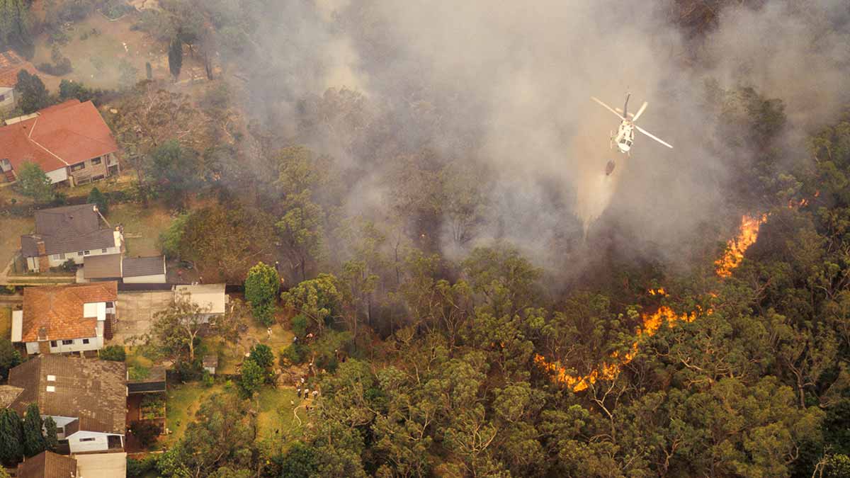
If you live in a high-risk area, take action now to prepare your household and property. Image: Getty
How to develop a bushfire survival plan
Emergencies can be overwhelming, so preparing before fire season is vital. Along with preparing your property, having a written and practised bushfire plan helps you act decisively under pressure. The CFA offers a bushfire survival planning template to guide you. Here is an outline of the steps you can take.
Step 1
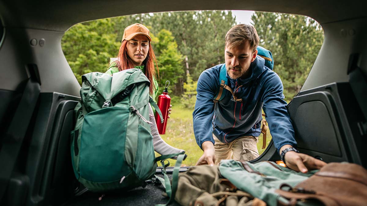
- Prepare an emergency kit so you can act quickly when conditions change. Include drinking water, non‑perishable food, first aid supplies, essential medications, protective clothing (long sleeves, cotton fabrics, sturdy boots), goggles, P2 masks, phone chargers, torches, batteries, copies of important documents, and a contact list. Store your kit in an accessible location and review contents at the start of each season, replacing expired items and updating contact details. This is a key step in preparing for bushfires.
Step 2
- Establish evacuation routes and meeting points for everyone in your household. Identify multiple routes in case roads are blocked, and nominate safe places outside high‑risk areas. Practise your plan, ensure children and older family members understand their roles, and share information with neighbours. Keep vehicles fuelled, have pet carriers and leads ready, and plan for animal relocation. Consider contingency arrangements for vulnerable or mobility‑impaired family members, including transport and support, to better prepare for a bushfire.
Step 3
- Decide ahead of time the triggers for leaving early. Base your decision on your property’s preparedness, everyone’s physical capability, forecast conditions and official warnings. Staying to defend should only be considered if your home is well‑prepared, all adults are capable and equipped, and the fire danger is not Extreme or Catastrophic. Leaving early is the safest option on Severe, Extreme or Catastrophic days, or whenever you are uncertain. Monitor VicEmergency for updates and heed directions from authorities.
Step 4
- Document your plan. Include communication methods, responsibilities, assembly points, essential items to take, and steps to secure your home before leaving (closing doors and windows, blocking gaps, moving flammables away from the house). Review and update the plan each year and after any significant changes to your property or household to ensure you continue preparing for bushfires effectively.
Step 5
- Download emergency services apps and save important numbers to your phone. See the list below.
Review your insurance policy to ensure you have adequate protection if a bushfire affects your property. Image: Getty
How to check your home insurance policy is up to date
Avoid underinsurance
- Review your home and contents insurance to ensure they provide enough protection, especially against bushfire risks.
- Update your building sum insured to reflect current rebuilding costs, including bushfire-resilient materials and compliance with building codes. Calculate the estimated cost to rebuild or repair your home using a home buildings calculator^.
- Confirm your contents cover accurately represents all household valuables, appliances, furnishings, and outdoor items (for example, tools, garden equipment). Calculate the estimated cost to repair or replace your contents by using a home contents calculator~.
- Regularly adjust your sum insured after renovations, changes in occupancy, or updates to local risk.
Do a home inventory
- Keep records of maintenance, upgrades, and improvements; store receipts and take photos of property conditions.
- Understand how bushfire-related claims work so you can navigate recovery smoothly.
- After an incident, document all damage thoroughly and contact your insurer promptly to start the claims process.
Review your policy terms
- Check your policy’s natural disaster coverage, including inclusions, waiting periods, and special conditions by reading the Product Disclosure Statement (PDS).
- Confirm coverage for outbuildings, fences, landscaping, solar systems, water tanks, and retaining walls.
- Find out if additional living expenses are covered if your home becomes uninhabitable.
- Consider optional contents cover, such as higher limits for valuables or accidental damage cover.
Use available resources
- RACV Home Insurance customers can access support and claims assistance online or via the RACV Emergency Assistance line, including guidance on next steps and temporary accommodation if needed.
- RACV’s insurance team can help assess your needs and tailor cover for bushfire season.
Annual policy review
- Revisit your policy every year, especially after major changes to your property or circumstances.
- Make sure your nominated excess and policy features match your budget and risk tolerance.
Make sure you prepare your emergency kit and essential items ahead of time. Image: Getty
How to prepare your motor vehicle for bushfire season
Check your car insurance
- Ensure your motor insurance is current and provides sufficient cover in case you need to make a claim.
- Read your Product Disclosure Statement (PDS) for a full list of conditions, limits, and exclusions.
- Contact your insurer to confirm policy limits, optional extras, renewal dates, and clarify any uncertainties.
Maintain your vehicle
- Have a mechanic check your vehicle for defects and ensure it’s in good working order.
- Make sure your vehicle battery is in good condition, as high temperatures can affect performance.
- Check your tyres have sufficient tread and are correctly inflated. Make sure your spare tyre is well maintained. That includes regular tyres, run-flat tyres and space-saver spare tyres. If you have an electric vehicle with a puncture repair kit, make sure that kit is packed and accessible.
Prepare your vehicle for emergencies
- Before an emergency, ensure your vehicle has enough fuel or charge (for EVs) in case evacuation is necessary.
- Stock your vehicle with emergency supplies such as water and pure wool blankets.
- If you're leaving a car behind when you evacuate, park it under a sheltered covering or purchase a tarp to protect it from bushfire debris and heat.
Download the RACV app to find nearby fuel and EV Chargefox stations across Australia.
Taking steps to get prepared before the fire season ensures you have a plan. Image: Getty
What emergency numbers and apps should I know for bushfire season?
Monitor the bushfire alert levels and Fire Danger Ratings in your area and always follow the advice and direction of emergency services.
If you live in a bushfire-prone area or you are travelling to regional or remote areas in Victoria, download the VicEmergency app to your smartphone and add the VicEmergency Hotline: 1800 226 226.
If you're in a life-threatening situation, call Triple Zero (000) immediately.
These resources and apps can help you during bushfire season:
- VicEmergency - app available to download for iPhone and Android
- ABC Listen - app available to download for iPhone and Android
- Bureau of Meteorology - app available to download for iPhone and Android
- The Country Fire Authority (CFA) website.
- Red Cross: Preparing for Emergencies - app available to download for iPhone and Android
The information provided is general advice only. Before making any decisions please consider your own circumstances and the Product Disclosure Statement and Target Market Determinations. For copies, visit racv.com.au. As distributor, RACV Insurance Services Pty Ltd AFS Licence No. 230039 receives commission for each policy sold or renewed. Product(s)issued by Insurance Manufacturers of Australia Pty Ltd ABN 93 004 208 084 AFS Licence No. 227678.
^TThe Cordell Sum Sure Estimate is an estimate of the cost to rebuild the improvements on your property and is generated by the Cordell Sum Sure Calculator which uses available property attribute information (including information you input or confirm) and/or information collated by Cotality about the subject property (from insurers and other third party sources) and analyses them against construction industry data to statistically derive a rebuild estimate through a series of computer implemented algorithms (Cordell Sum Sure Estimate).
The Cordell Sum Sure Estimate does not take into account individual design features, site specific conditions, structural conditions and materials, local planning laws or any other regulations and may not be suitable for your particular circumstances. The Cordell Sum Sure Estimate is an indicative guide only and must not be relied upon as an accurate representation of the costs associated with rebuilding your property or in lieu of appropriate professional advice.
While Cotality uses commercially reasonable efforts to ensure the Cordell Sum Sure Estimate is current, Cotality does not warrant the accuracy, currency or completeness of the Cordell Sum Sure Estimate and to the full extent permitted by law excludes all liability for any loss or damage howsoever arising (including through negligence) in connection with the Cordell Sum Sure Estimate.
~ Typical home contents replacement costs are provided by Sum Insured. Whilst all reasonable care is taken to ensure the accuracy of the information as a guide for costing building contents replacement costs, no responsibility is accepted by Sum Insured for its accuracy. Please check with a Valuer or other suitably qualified professional for an accurate costing estimate. Insurance Australia Limited (A.B.N. 11 000 016 722) takes no responsibility for the costs provided by Sum Insured nor any liability for the accuracy of or reliance upon or use of, the costs.
This service is licensed to Insurance Australia Limited (A.B.N 11 000 016 722) for use by its customers.

