With six RACV Resorts across Victoria, you’re spoilt for choice. Use this guide to the best things to do near each resort to help plan your perfect Victorian holiday.
Victoria

Best walks, hikes and trails near RACV Cobram Resort
Best walks near RACV Resorts in Queensland
RACV Royal Pines Resort, Gold Coast
Best walks, hikes and trails near RACV Resorts
Looking for the best walks near RACV Resorts in Victoria and Queensland? Whether you’re after an easy coastal stroll, a family‑friendly bushwalk or a longer hike through national parks, there are plenty of scenic walking tracks located just a short drive from RACV resorts.
From rugged clifftop walks near RACV Cape Schanck to relaxed beach walks near RACV Inverloch Resort, as well as bushland trails close to RACV Torquay, Goldfields, Cobram and Healesville resorts, these walks are ideal for day trips, morning wanderings or post‑breakfast adventures during your stay.
With options to suit all fitness levels, interests and seasons, here are some of the best walks, hikes and trails to explore when staying at an RACV resort.
Many of these walks can also take on extra meaning if you’re looking to combine time outdoors with giving back. Throughout April 2026, participants in Hike4Life are encouraged to set a personal walking goal and raise funds for Youth Live4Life, a program dedicated to youth mental health and suicide prevention.
Running from 1–28 April 2026, Hike4Life invites individuals and teams across Victoria and Australia to choose a kilometre target and fundraising goal, then work towards both over four weeks. Every dollar raised helps support the expansion of Live4Life’s youth mental health and suicide prevention programs, which RACV proudly supports, having recently extended funding to help the charitable organisation reach more rural and regional communities across Victoria.
RACV Members save more on holidays at RACV Resorts, including camping and caravan facilities.
The views are stunning on the Cape Schanck and Pulpit Rock Loop. Image: Visit Victoria
Best walks near RACV Resorts in Victoria
Best walks, hikes and trails near RACV Cape Schanck Resort
When it comes to the Mornington Peninsula, you’ll never go wanting for a good brush with nature on a scenic trail. From spectacular seaside tracks to dense bushland trails, there’s a walk to suit almost every fitness level, duration and scenery request out there.
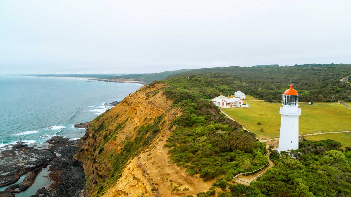
Cape Schanck and Pulpit Rock walk near RACV Cape Schanck Resort
- Length: 1.8km
- Ability: Easy
- Dogs: No
This popular short walk winds through coastal bushland near Cape Schanck Lighthouse and takes about half an hour to complete. Located within Mornington Peninsula National Park, the loop begins at the Cape Schanck picnic and parking area and passes several lookout points before reaching Pebble Beach. A wooden staircase and boardwalk provide access to this small rock‑pool area. Pulpit Rock, formed through volcanic and geological movement over millions of years, sits just off the beach.
Notes: Be alert down on the rocks at Pebble Beach: unexpected waves may wash over the rocks.
Bushrangers Bay walk near RACV Cape Schanck Resort
- Length: 6.1km
- Ability: Intermediate
- Dogs: No
The Bushrangers Bay walk takes around 1.5 hours to complete. Starting at the Boneo Road car park, the track winds through coastal banksias rich in birdlife before reaching the bay – a long sandy beach backed by basalt cliffs. At the shoreline, the calm tidal estuary meets the open ocean. You can dip your toes in the water here and spot the distinctive Elephant Rock spire.
Notes: There's limited shade on this track, so apply sunscreen and wear a hat.
Two Bays Walking Trail near RACV Cape Schanck Resort
- Length: 25.4km
- Ability: Advanced
- Dogs: No
For those looking for a longer trek, the full Two Bays Walking Trail is the longest continuous walking track on the Mornington Peninsula. Spanning almost 26km, the trail takes about seven hours to complete. Starting at Dromana’s La Trobe Parade car park on Port Phillip Bay, it passes through the bush and beach landscapes of Arthurs Seat State Park and Mornington Peninsula State Park before reaching Bushrangers Bay and finishing at Cape Schanck Lighthouse. Stay at the nearby RACV Cape Schanck Resort to treat yourself to a wonderful night of rest.
Notes: Follow the circular blue wren symbols along the track to stay on course, and bring enough water for your entire walk.
Bells Beach is a famous surfing beach in Torquay. Image: Visit Victoria
Best walks, hikes and trails near RACV Torquay Resort
Best known for its surfing culture, Torquay is home to Bells Beach and Jan Juc Beach. See for yourself how the Surf Coast got its name on these scenic coastal trails.
Surf Coast Walk near RACV Torquay Resort
- Length: Variable - up to 44km
- Ability: Easy to intermediate (depending on track)
- Dogs: Yes (on leash)
The Surf Coast Walk follows the famous Great Ocean Road along one of Victoria’s most popular coastlines, from Torquay to Aireys Inlet. With golden beaches, rugged cliffs and eucalyptus-scented air, the Surf Coast Walk offers coastal magic.
Conveniently broken into 12 distinctive trails, each walk allows you to choose your own adventure across one day or many. Beginners can look at the 1.6km Torquay Promenade trail, while more experienced hikers might enjoy exploring the Sunnymead-Urquart Bluff and Sunnymead Trail (3km), featuring a rougher track with rugged terrain.
Notes: Bring binoculars between May and October for the chance to spot migrating whales.
Bells Beach and Point Addis walk near RACV Torquay Resort
- Length: 10.8km
- Ability: Moderate
- Dogs: Yes (on leash)
This coastal loop may be on the longer side, but the surf beaches and ocean views are worth the effort. Taking about 2 hours 45 minutes to complete, the walk starts at Point Addis car park and follows the beachfront, passing Addiscot Beach, Southside Beach and Bells Beach. The route then turns inland along the Surf Coast Walk and Jarosite Track, winding through wattle trees, paper daisies and scrubby gums. Plan your walk carefully to avoid being on the beach at high tide.
Notes: Bells Beach is one of Australia's most famous surfing spots, home to one of world's biggest surfing competitions: the Rip Curl Pro.
Anglesea Heath Walk
- Length: 6.42km
- Ability: Intermediate
- Dogs: Yes (on leash)
Venture further down the Great Ocean Road towards Anglesea for the Anglesea Heath Walk, where ochre cliffs, blue ocean and green heathlands line the coast. This is the sixth of 12 sections of the Surf Coast Walk, covering the stretch from Point Addis to Anglesea.
Notes: Combine this walk with Anglesea Riverbanks, an easy stroll along the river that conveniently passes barbecues, playgrounds and cafes.
The St George's Lake Loop walk is great for families. Image: Visit Victoria
Best walks, hikes and trails near RACV Goldfields Resort
Steeped in history and full of vibrant culture, Creswick has plenty to offer the avid explorer, including some of regional Victoria's best historical experiences, along with some amazing walks.
St George's Lake Loop Walk near RACV Goldfields Resort
- Length: 1.8km
- Ability: Easy
- Dogs: Yes (on leash)
If you prefer lakeside views, try the gently undulating track around the shores of St George’s Lake, once a mining dam known as Govvy Dam. Ideal for families and nature enthusiasts, this easy walk takes around half an hour to complete and offers opportunities to spot waterbirds. Finish with a picnic at the BBQ area near the car park.
Notes: There are wheelchair-accessible ramps to the picnic area and viewing platform.
Creswick Heritage Walk near RACV Goldfields Resort
- Length: 8.5km
- Ability: Intermediate
- Dogs: Yes (on leash)
Start the Creswick Heritage Walk in the centre of town, where there are several parking options. The route passes through the University of Melbourne’s Creswick campus before joining part of the Goldfields Track and moving past several points of interest, including former stables, the La Gerche Forest Walk and the northern edge of St George’s Lake. You can extend the walk with a loop around St George’s Lake if you wish.
Notes: The La Gerche Forest Walk is named for the 100-year-old trees planted by Creswick’s first forest bailiff, John La Gerche.
Creswick Miner's Walk near RACV Goldfields Resort
- Length: 25.4km
- Ability: Intermediate
- Dogs: Yes (on leash)
This section of the celebrated 210km Goldfields Track takes you on a historical journey from Creswick to Ballarat. It forms part of the longer Eureka Walk, which leads from Creswick through Ballarat to Mount Buninyong. The route follows the path taken by 200 Creswick miners who marched to Ballarat in 1854 to protest for justice at the Eureka Stockade. Look out for the quartz trail markers, which once reflected moonlight to guide the miners along the way.
Notes: Allow four to five hours one way, and be sure to wear comfortable shoes.
Eagle's Nest is a fantastic viewpoint on the Screw Creek Nature Walk.
Best walks, hikes and trails near RACV Inverloch Resort
Situated on the Bass Coast a few hours southeast of Melbourne, Inverloch is located between picturesque countryside and popular beaches. Perfect for exploring, the walks surrounding Inverloch hold a variety of treasures waiting to be discovered.
Inverloch Foreshore Walking Track near RACV Inverloch Resort
- Length: 5km
- Ability: Easy
- Dogs: Yes (on leash)
You can’t go past the Inverloch Foreshore Walking Track on a visit to Inverloch. Enjoy views across Anderson Inlet and Point Smythe, with picnic areas, exercise stations and the Rainbow Park playground along the way. Stop for a swim in the clear waters, then browse the cafés and shops just across the road at your leisure.
Notes: This track is pram and wheelchair friendly.
Screw Creek Nature Walk/Townsend Bluff Circuit near RACV Inverloch Resort
- Length: 3km
- Ability: Easy
- Dogs: Yes (on leash)
A great walk for families with kids, this gently undulating trail includes sections of boardwalk and winds through mangroves, tea trees and salt marsh to a lookout at Townsend Bluff, with views over Anderson Inlet. The walk begins and ends at the parking area at the end of The Esplanade in Inverloch and takes under half an hour to complete.
Notes: This scenic walk is called either the Screw Creek Nature Walk or the Townsend Bluff Circuit depending on your source.
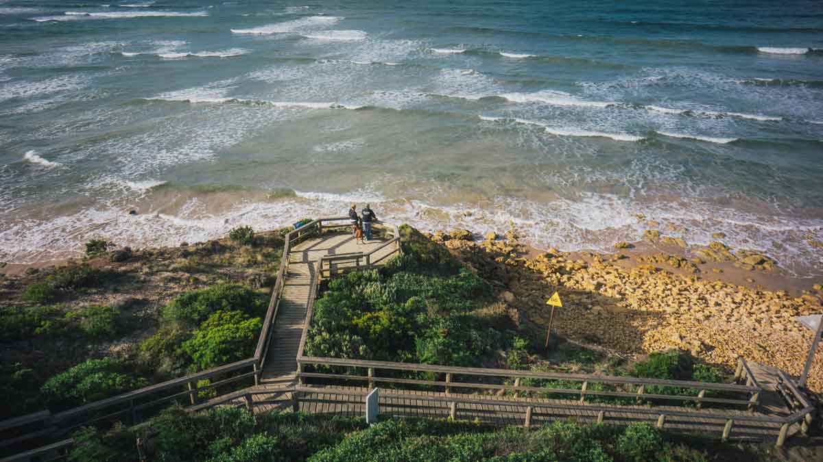
Inverloch Surf Beach to The Caves near RACV Inverloch Resort
- Length: 7.7km
- Ability: Intermediate
- Dogs: Yes (on leash)
After a longer excursion? Walk from the swells of Inverloch Surf Beach along Bunurong Marine Park to The Caves. At low tide, an excavation site known as Dinosaur Dreaming is revealed at the base of the cliffs. More than 6,000 bones, teeth and footprints from small dinosaurs have been uncovered here, dating back 115 million years. Climb the stairs to The Caves lookout for views over the Bass Coast, and watch for whales if you’re visiting between May and November.
Notes: Check the tides before you leave and make sure to only walk this route at low tide.
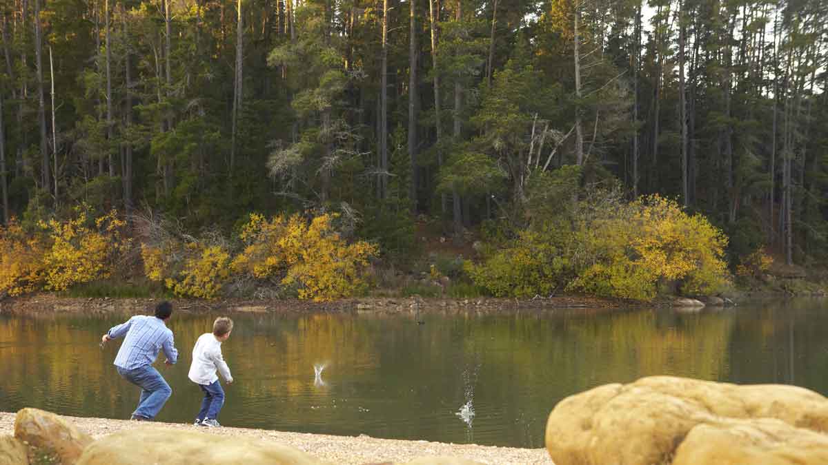
For a dose of fresh country air, take a walk among the tall eucalypts near Cobram.
Best walks, hikes and trails near RACV Cobram Resort
Cobram sits on the Murray River, which forms the border between Victoria and New South Wales. Located in the heart of what’s known as the ‘food bowl of Australia’, the area is renowned for its climate, fresh produce and picturesque scenery.
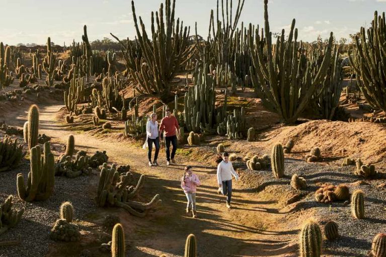
Cactus Country near RACV Cobram Resort
- Length: N/A
- Ability: Easy
- Dogs: No
One of the most unique walks on the list, Cactus Country is a 4.8ha garden filled with cacti and succulents from Mexico, Argentina and Africa. Explore the eight garden trails before stopping at the onsite Mexican restaurant for lunch or a cactus ice cream. You can also pick up live cacti or cactus‑themed gifts, such as cactus honey, from the gift shop before you leave.
Notes: There's a cactus scavenger hunt for kids for extra fun.
Broken Creek Track near RACV Cobram Resort
- Length: 4km
- Ability: Easy
- Dogs: No
For another walk unique to the Murray region, visit Barmah National Park, which spans 60,000 hectares and is home to the world’s largest river red gum forest. The Broken Creek Track is a loop walk that takes just under an hour to complete, meandering along Broken Creek and starting and finishing at the Dharnya Centre, the cultural hub of the local Yorta Yorta people.
Notes: Broken Creek is also an area widely known for its great fishing.
Quinns Island Wetland Sanctuary near RACV Cobram Resort
- Length: 3.2km
- Ability: Easy
- Dogs: No
Just outside Cobram is Quinns Island Wetland Sanctuary, a 40ha island rich in waterbird life. Access the island via the bridge off River Road. To fully explore the area, combine the 2.5km Loop Track with the 1.2km walk to Cobrooga Beach and the 300m track to the Day Visitor Shelter. Along the way, you may spot a large bird hide, quiet beaches and possible Aboriginal artefacts such as flint tools, scar trees and middens.
Notes: Quinns Island was formed by a bend in the Murray River cut off by Scott's Creek.
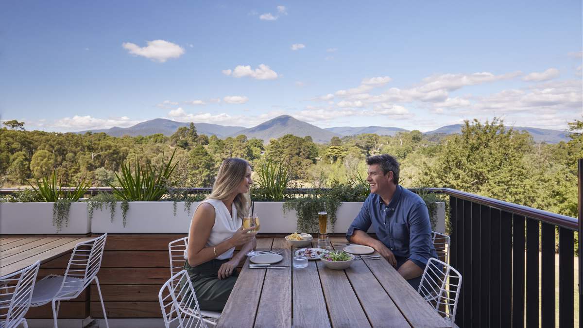
Stop in for a meal at RACV Healesville Resort's Banyalla after your walk.
Best walks, hikes and trails near RACV Healesville Country Club & Resort
While many people associate Healesville with the Yarra Valley’s boutique wineries, breweries and distilleries, this stunning area is also known for its scenic routes, rolling valleys and mountains of lush greenery, with food and drink options available at the end of the day.
Badger Weir Loop Walk near RACV Healesville Country Club & Resort
- Length: 2.7km
- Ability: Intermediate
- Dogs: No
Taking just under an hour to complete, the Badger Weir Loop Walk is located in Yarra Ranges National Park near Healesville. The track follows Coranderrk Creek, passing lush riverside ferns, fungi and tall mountain ash trees, and crossing several wooden bridges along the way. The walk starts and finishes at the Badger Weir Picnic Area, which has public parking, toilets and barbecue facilities.
Notes: The gate to Badger Weir opens at 8am. Closing hours may change throughout the year.
Maroondah Reservoir Park near RACV Healesville Country Club & Resort
- Length: 3km
- Ability: Easy - Intermediate
- Dogs: Yes (on leash - but not in picnic areas, lookout or dam wall)
Spend an afternoon exploring Maroondah Reservoir Park, with its domed gardens, 41‑metre dam wall and expansive reservoir. There are four main tracks to explore. The Lookout Track leads from the car park up the Rose Stairway to the dam wall for views over the area. From there, follow the Maroondah Forest Track to Henderson’s Picnic Area, where a 1.4km track climbs to the top of Henderson’s Hill and connects with other walks to and from Donnelley’s Weir. The Scenic Views Track also winds through grassy areas and mature exotic trees to the top of the dam wall, offering views of the surrounding mountains.
Notes: When the dam overflows the spillway once or twice a year, the Falls Lookout gets you to the best views of the resulting waterfall.
Tanglefoot Loop near RACV Healesville Country Club & Resort
- Length: 10km
- Ability: Intermediate - Advanced
- Dogs: No
Explore Toolangi State Forest, a true rainforest environment, via the Tanglefoot Loop Trail. Taking two to three hours to complete, the loop starts at the Wirrawilla Rainforest car park and winds through eucalypts and ferns, with several short, steep hills along the way. Keep an eye out for parrots, rosellas, honeyeaters and even lyrebirds.
Notes: Bring proper hiking shoes to this walk: it's often wet and muddy.
Follow the shoreline between Noosa and Sunshine Beach for spectacular views. Image: Getty
Best walks near RACV Resorts in Queensland
While most RACV resorts are located across Victoria, there are also great walking tracks close to RACV resorts in Queensland, including Noosa and the Gold Coast.
RACV Noosa Resort, Sunshine Coast
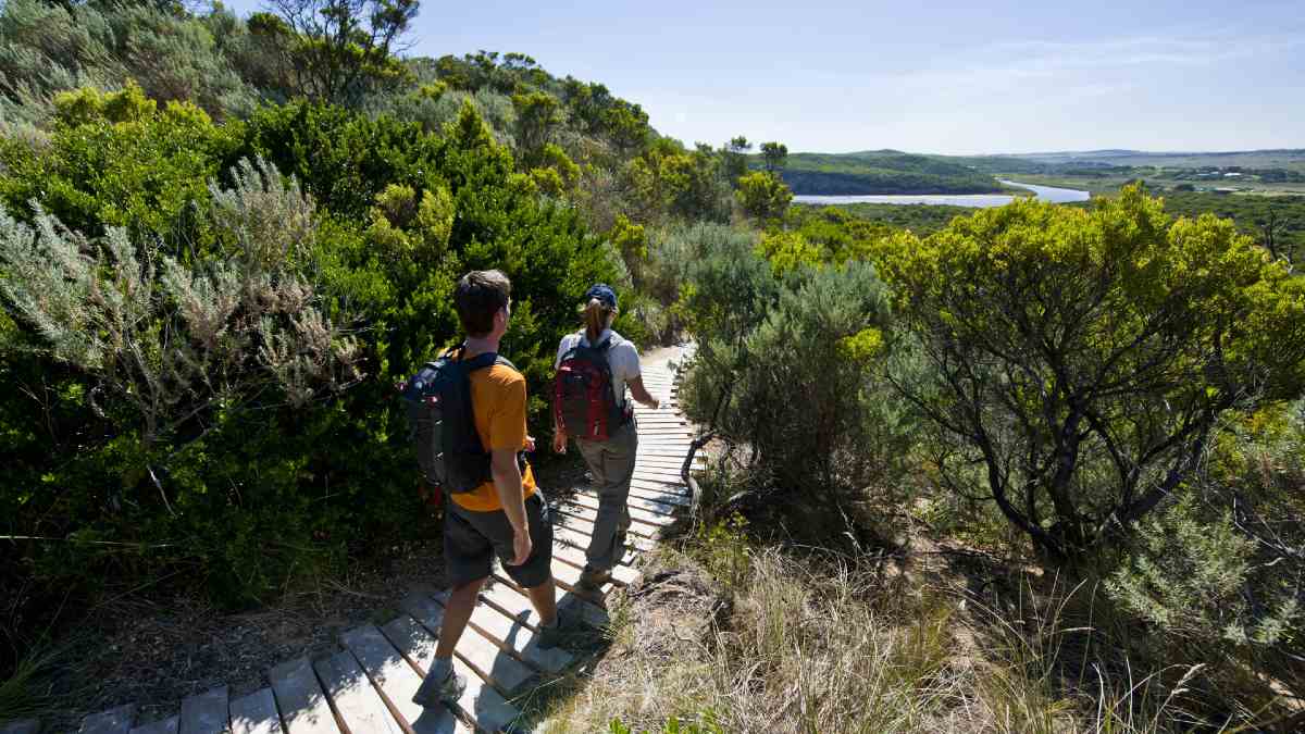
Staying at RACV Noosa Resort places you close to some of the Sunshine Coast’s most popular coastal and national park walks, with several tracks just minutes from the resort. The area offers a wide range of trails to suit different interests and abilities, from relaxed beach strolls to multi‑day hikes along the coast.
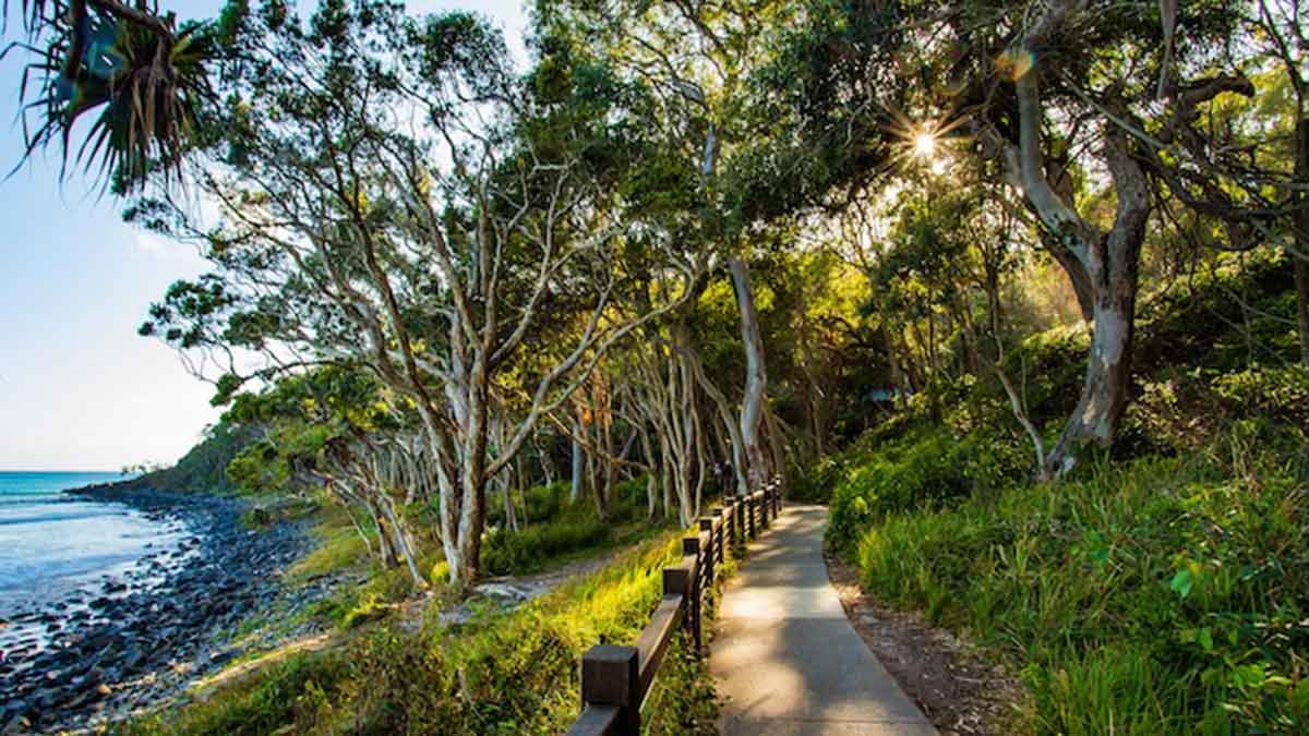
Noosa National Park Coastal Walk near RACV Noosa Resort
- Length: 9.8km
- Ability: Intermediate
- Dogs: No
Noosa National Park features a range of excellent walking trails, with one of the most popular loop walks taking in the lookout points at Hells Gates, Dolphin Point and Boiling Pot, where waves crash against rugged rocks. Taking around 2.5 hours to complete, the walk starts at the Noosa Parade/Noosa Drive parking area and follows a scenic coastal route. Look up to spot koalas in the trees, watch the water for turtles and dolphins, and scan the coastline for humpback whales between June and November.
Notes: The RACV Noosa Resort offers a free shuttle service between the resort and Noosa Main Beach, just off Noosa National Park.
Noosa River Foreshore Path
- Length: 3.4km
- Ability: Easy
- Dogs: Yes (on leash)
There’s no better way to discover Noosa than with a walk along the Noosa River. This popular route is well used by local walkers, runners and dog walkers. Taking around 40 minutes to complete, the Noosa River Foreshore Path is especially pleasant at sunrise or sunset. Enjoy the many cafés and restaurants along the way and choose a spot for brunch.
Notes: This walking track is wheelchair and pram friendly.
Alexandria Bay Walk
- Length: 4.2km
- Ability: Easy
- Dogs: No
Get your toes in the sand on the walk from Noosa to Alexandria Bay, known for its white sand and clear ocean waters. Starting from Parkedge Road, follow the wide sandy track through eucalypts, pink bloodwoods, coastal banksia and pandanus palms. The trail then descends into damp heathlands filled with sedges, rushes and coral ferns before reaching Alexandria Bay. Enjoy a dip before heading back.
Notes: Bring binoculars on this route if you have them: it's a great location for birding.
The Springbrook Park Trail takes you along creeks, waterfalls and hidden natural gems. Image: Getty
RACV Royal Pines Resort, Gold Coast
Located on the Gold Coast, RACV Royal Pines Resort is close to bushland reserves, river walks and hinterland trails, offering easy walking options away from the coastline.
Burleigh Head Oceanview and Rainforest Circuit near RACV Royal Pines Resort
- Length: 3.1km
- Ability: Easy
- Dogs: No
Offering views of both the coastline and hinterland, Burleigh Head National Park features rainforests, mangroves, creeks, beaches and a variety of Australian wildlife. This easy circuit takes about an hour to complete and covers many highlights of the park. Starting at the rocky headland, the walk follows the coast with ocean views and the chance to spot sea eagles overhead and whales in spring. The track then follows Tallebudgera Creek inland before joining the rainforest circuit. Pause at Tumgun Lookout and Jebbribillum Lookout for views through the trees, and explore Echo Beach at low tide. The walk continues through eucalypt forest and a few short hills before returning to the car park.
Notes: Parking can get competitive during peak times, so consider going early in the morning.
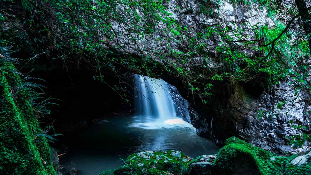
Twin Falls Circuit, Springbrook National Park near RACV Royal Pines Resort
- Length: 4.2km
- Ability: Intermediate
- Dogs: No
It’s just under an hour’s drive from RACV Royal Pines Resort to Springbrook National Park, and the walk is well worth the trip. The 1.5‑hour Twin Falls Circuit is best walked in an anti‑clockwise direction, winding through subtropical rainforest. Along the way, you’ll pass rock formations, spot birdlife, enjoy views stretching to Surfers Paradise, and see two waterfalls framed by palms and brush box trees.
Notes: Tallanbana Picnic Area, located near the trailhead, offers public parking, toilets, sheltered picnic tables and information boards.
Nerang Goat Track Loop near RACV Royal Pines Resort
- Length: 7.2km
- Ability: Intermediate
- Dogs: No
Head to Nerang National Park for a challenging walk from the Nerang Velodrome into the park’s eastern section. The Nerang Goat Track Loop is named for its steep incline at the start, before levelling out as it continues clockwise for around two hours and 15 minutes. Along the way, there’s plenty of dry rainforest and open eucalypt forest to enjoy in the Gold Coast hinterland.
Notes: This route is also popular with cyclists, trail runners and horse riders. Be aware and keep to the left to allow them to pass.
The Great Ocean Walk takes around eight days to complete, but it can also be enjoyed in shorter sections suited to a range of fitness and experience levels. Image: Visit Victoria.
Frequently asked questions about walks near RACV Resorts
Some of the best easy walks near RACV Resorts include the Cape Schanck and Pulpit Rock walk, Inverloch Surf Beach walk, Screw Creek Nature Walk and Maroondah Reservoir Park walks. These tracks are generally short, well‑formed and suitable for beginners, families and casual walkers.
Yes, several walks near RACV Resorts allow dogs on lead, including sections of the Surf Coast Walk, Murray River walking tracks near RACV Cobram Resort and Mount Buninyong Summit walk. These walks are ideal for a day trip from Melbourne, especially if you’re bringing your dog along. Always check local signage and park regulations before bringing your dog.
Please note: Pets are not permitted at any RACV Resorts, except for guide and assistance dogs accompanying a visually impaired person or hearing impaired person.
RACV Cape Schanck Resort, RACV Torquay Resort and RACV Inverloch Resort are all excellent bases for coastal walks. These resorts are located close to clifftop trails, surf beaches and scenic coastal paths along Victoria’s coastline.
Most walks featured are located within a short drive of RACV Resorts, with many trails starting less than 15 minutes away. Some walks, such as beach walks near RACV Inverloch Resort, can be accessed directly from the surrounding area.
Yes. Longer hikes near RACV Resorts include the Two Bays Walking Trail near RACV Cape Schanck Resort and extended sections of the Surf Coast Walk near RACV Torquay Resort, offering more challenging options for experienced hikers.