Stats on roadstrike are at record levels in Victoria. Here's how you can help prevent hitting wildlife in your car and what to do if it happens.
Safety
Have your say on the worst roads in regional Victoria
Take part in RACV’s 2026 My Country Road survey to help shape road safety across Victoria’s regions.
Victorians are being urged to have their say on dangerous regional roads through RACV’s My Country Road survey.
The 2026 survey invites feedback on dozens of roads identified by RACV, while also giving Victorians the chance to nominate others of concern.
“Regional roads account for more than half of all road crashes in Victoria and too many remain unsafe,” RACV Head of Policy James Williams says.
“Through RACV’s My Country Road survey, we’re giving Victorians a direct voice on the roads they know need attention.”
The survey is open from June 3 to July 17 2026.
More than 50 dangerous country roads identified
RACV worked with the Australian Automobile Association (AAA) to analyse 19,800 kilometres of roads across regional Victoria to shortlist the most dangerous roads in the survey. The analysis utilised Australian Road Assessment Program (AusRAP) data, including design features, crash history and traffic volumes, to identify 52 dangerous sections of country highways.
These 52 dangerous roads have been grouped into five regional areas; North West, North East, West, East, and South West. Survey respondents have the opportunity to comment on up to three of the 52 identified roads or nominate their own.
Use the tables below to see the full list of 52 dangerous country roads identified.
| Road | |
|---|---|
|
Glenelg Highway |
Dunkeld to Hamilton |
|
Glenelg Highway |
Hamilton to SA border |
|
Great Ocean Road |
Lorne to Apollo Bay |
|
Great Ocean Road |
Port Campbell to Apollo Bay |
|
Great Ocean Road |
Warnambool to Port Campbell |
|
Hamilton Highway |
Mortlake to Hamilton |
|
Henty Highway |
Portland to Hamilton |
|
Midland Highway |
Ballarat to Geelong |
|
Princes Highway West |
Colac to Camperdown |
|
Princes Highway West |
Portland to Port Fairy |
| Road | |
|---|---|
|
Glenelg Highway |
Lake Bolac to Dunkeld |
|
Henty Highway |
Horsham to Hamilton |
|
Midland Highway |
Ballarat to Daylesford |
|
Midland Highway |
Castlemaine to Daylesford |
|
Pyrenees Highway and Glenelg Highway |
Dunkeld to Ararat |
|
Pyrenees Highway |
Avoca to Ararat |
|
Western Highway |
Ararat to Stawell |
|
Western Highway |
Ballarat to Trawalla |
|
Western Highway |
Horsham to Stawell |
|
Western Highway |
Nhill to Horsham |
| Road | |
|---|---|
|
Calder Highway |
Ouyen to Charlton |
|
Calder Highway |
Ouyen to Mildura |
|
Loddon Valley Highway |
Bendigo to Kerang |
|
Mallee Highway |
Ouyen to SA border |
|
Murray Valley Highway |
Swan Hill to Robinvale |
|
Northern Highway |
Echuca to Heathcote |
|
Northern Highway and McIvor Highway |
Wallan to Bendigo |
|
Pyrenees Highway |
Mayborough to Castlemaine |
|
Robinvale-Sea Lake Road |
Robinvale to Manangatang |
|
Sunraysia Highway |
St Arnaud to Donald |
| Road | |
|---|---|
|
Beechworth-Wangaratta Road |
Wangaratta to Beechworth |
|
Goulburn Valley Highway and Maroondah Highway |
Yea to Mansfield |
|
Great Alpine Road |
Wangaratta to Bright |
|
Maroondah Highway |
Alexandra to Healesville |
|
Melba Highway |
Yea to Dixons Creek |
|
Midland Highway |
Benalla to Mansfield |
|
Midland Highway |
Shepparton to Benalla |
|
Murray Valley Highway |
Cobram to Yarrawonga |
|
Murray Valley Highway |
Corryong to Tallangatta |
|
Murray Valley Highway |
Wodonga to Tallangatta |
|
Murray Valley Highway and Echuca Road |
Echuca to Shepparton |
| Road | |
|---|---|
|
Bass Highway |
San Remo to Wonthaggi |
|
Bass Highway |
Wonthaggi to Leongatha |
|
Great Alpine Road |
Bairnsdale to Omeo |
|
Monaro Highway |
Cann River to NSW border |
|
Princes Highway East |
Bairnsdale to Lakes Entrance |
|
Princes Highway East |
Lakes Entrance to NSW border |
|
South Gippsland Highway |
Foster to Leongatha |
|
South Gippsland Highway |
Foster to Yarram |
|
South Gippsland Highway |
Loch to Leongatha |
|
South Gippsland Highway |
Yarram to Sale |
|
Strzelecki Highway |
Leongatha to Mirboo North |
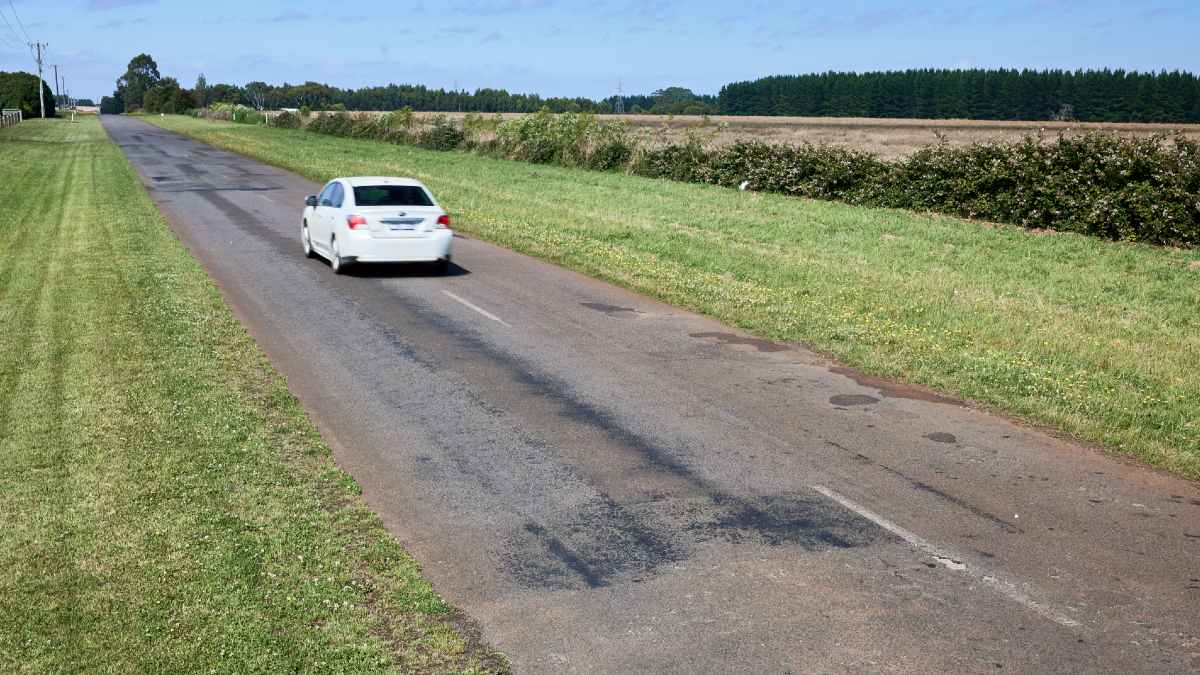
Narrow roads and shoulders, potholes and faded line markings are some of the hazards road users face on country roads in Victoria. Image: Matt Harvey
RACV calling for regional roads to be improved
The roads highlighted in the 2026 My Country Road survey are all rated 1 or 2 stars by AusRAP. As a general rule, the risk of death or serious injury halves with each additional AusRAP star a road achieves.
RACV is advocating for major roads to be upgraded to at least a 3-star AusRAP safety rating on existing sections, and at least 4 stars on new sections.
“Regional roads can present unique hazards, including potholes, narrow shoulders, changing speed zones and limited safe overtaking opportunities. Slowing down, driving to the conditions and avoiding fatigue are critical to keeping everyone safe,” Williams says.
“This campaign provides governments with the information to prioritise limited funding based on feedback from the people who use these roads.”
The My Country Road survey is open now until Friday, July 17. Take part online at racv.com.au/haveyoursay.