
Summer in Victoria can increase risks for extreme weather events that can put your health and home at risk. Learn how to stay safe, keep cool and protect your home during heatwaves.
News

What is an Indian Ocean Dipole (IOD) weather system?
Why Victorians should brace for more wet and wild weather
Pack your umbrellas. A negative Indian Ocean Dipole event is currently underway in Australia. This is what the weather system means for Victoria and why it’s going to keep raining on our parade.
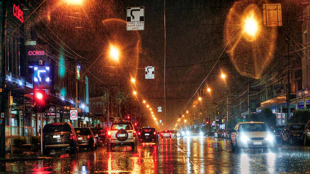
"Marge, the rains are here"... and there’s more on the way.
Victorians are bracing for more wet weather as back-to-back climate events converge to dampen the state’s spirits until the end of the year.
The Bureau of Meteorology has confirmed a negative Indian Ocean Dipole (IOD) is currently underway and will most likely continue into late spring, bringing with it increased rainfall over much of southern and eastern Australia.
Dr Andrew Watkins, Bureau of Meteorology senior climatologist and head of long-range forecasting, says the rainfall outlook for the coming three months is for wetter than normal conditions across much of the eastern two-thirds of Australia.
“Typically, a negative Indian ocean dipole sees wetter than normal winter and spring conditions across southern and eastern Australia,” he says.
It’s a wet weather double-whammy for Australia’s eastern board, with the above average rainfall caused by the negative IOD increasing the chance of La Niña forming in the latter half of 2022.
These predictions for a wetter and warmer spring come after Australia experienced a negative Indian Ocean Dipole in 2021. This saw the country record the wettest year since 2016, and the wettest November on record.
It’s the first time since the 1960s Australia has experienced a negative IOD for two consecutive years.
Here is everything you need to know about the current Indian Ocean Dipole event and what it means for Victoria's weather.
What is an Indian Ocean Dipole (IOD) weather system?
The Indian Ocean Dipole describes a natural climate cycle defined by the difference in sea surface temperature between two areas (or poles, hence a dipole). Put simply, it is a change in the temperature patterns out in the tropical Indian Ocean.
During a negative phase, Dr Watkins explains, we tend to see warmer conditions off Indonesia and cooler than normal conditions off Africa. “The weather patterns tend to follow where that warmer water is and shift the wetter conditions across towards Australia."
What is the difference between a negative or positive IOD event?
According to the Bureau of Meteorology’s climate outlook report for August to October, above average rainfall and warmer than average temperatures are expected for most of Australia. Night-time temperatures are predicted to be higher than normal.
How long will the Indian Ocean Dipole event last?
Weather systems are generally grouped into neutral, positive, or negative phases.
A neutral IOD phase occurs when the temperatures in the west (off Africa) and the east (off Indonesia and Australia) are roughly normal. When waters in the eastern Indian Ocean become warmer than normal, while waters off Africa become cooler, this is known as a negative phase and is largely the result of prevailing wind patterns.
This year, however, when the IOD event starts to lose intensity, it might pass the proverbial rain baton to La Nina, keeping the country soggy well into summer.
What should Victorians watch out for during the IOD event?
Australia’s severe weather season runs from October to April, which means Victorians should remain vigilant and be prepared for inclement weather conditions. Off the back of the wettest year since 2016, Dr Watkins says Victoria is at increased risk of floods.
“At the moment we have wet soils, full rivers and full dams, and a wet outlook for the eastern two thirds of Australia,” he says. “So that means the flood risk remains elevated for eastern Australia.”
What is the difference between a negative Indian Ocean Dipole event, El Niño and La Niña?
Indian Ocean Dipole
A negative IOD affects Australia's temperatures as well as its rainfall. Across the southern mainland, cooler-than-average days are more likely from June to November, although overnight temperatures are generally normal. The snow season typically finishes later and with deeper peak snow.
El Niño
At the opposite end of the weather spectrum, the El Niño-Southern Oscillation (or ENSO) typically brings drier than average conditions to eastern Australia during winter and spring, and warmer days across the southern two-thirds of the country.
The term El Niño refers to the extensive warming of the central and eastern tropical Pacific Ocean which leads to a major shift in weather patterns across the Pacific. This occurs every three to eight years.
La Niña
La Niña weather events are also part of the ENSO cycle. During La Niña, waters in the central or eastern tropical Pacific become cooler than normal, persistent south-east to north-westerly winds strengthen in the tropical and equatorial Pacific, and clouds shift to the west, closer to Australia.
For further updates, keep an eye on the Bureau of Meteorology website and also on the BOM weather app.
Preparing your home and contents for wet weather
Severe weather such as strong winds, hail, storms, or flash flooding can wreak havoc on your home, vehicles, and household contents. Make sure you and your home are ‘storm safe’ and prepare your home:
- Keep gutters clean to avoid blockages and damage
- Trim your trees to decrease the chance of storm or wind damage
- Secure any large items, such as a bookcase that can cause damage in a storm
- Have any roof damage, including broken or missing tiles fixed by a professional
- Have an action plan and emergency safety kit on hand in case you and your family are confronted with an emergency
- Be prepared for a power outage and follow our guide on what to do in a blackout
Always contact emergency services on 000 in the event of an emergency
How to protect your car from severe weather
In inclement or severe weather, make sure you are taking the necessary precautions to ensure you and your vehicle are safe on the road. Every year extreme winds, hail, cold, storms, and flooding increase the risk of damage and accidents with motor vehicles.
Be prepared by taking the following precautions:
- Ensure you are covered for any damages with adequate Motor Insurance and Emergency Roadside Assist should you get stuck
- Keep up to date with the Bureau of Meteorology’s Victorian Warnings Summary
- If a storm is on the horizon, look to move vehicles under shelter if available, or under a tarpaulin.
- If you are looking to drive in the snow, check out our guide to know how to prepare your vehicle for driving and parking
If you are caught in a rainstorm while driving:
- Turn on your lights to improve visibility
- Avoid parking under trees or loose branches
- Avoid driving into flooded waters
- Keep away from mud, debris, damaged roads, and fallen items like trees and powerlines
- If your vehicle is a victim of hail damage, read our guide
RACV also has a dedicated resource for preparing for severe weather in Victoria here.
This is general advice only and does not take into account your individual objectives, financial situation or needs (“your personal circumstances”). Before using this advice to decide whether to purchase a product, you should consider your personal circumstances and the relevant Product Disclosure Statement and Target Market Determination. For copies, visit racv.com.au.
RACV Contents Insurance issued by Insurance Manufacturers of Australia Pty Limited ABN 93 004 208 084 AFS Licence No. 227678. As distributor, RACV Insurance Services Pty Ltd AFS Licence No. 230039 receives commission for each policy sold or renewed.

